

On this page
Bangalore, Karnātaka, India
Overview
At Global Technology Center (GTC), Bengaluru, we are looking for motivated and experienced individuals to join the GTC GIS team. The role of Senior GIS Analyst is an exciting and rewarding opportunity to gain experience in GIS analysis and the implementation of GIS solutions across multiple disciplines throughout all stages of a project's lifecycle.
The successful candidate will be responsible for managing GIS analysis projects across engineering disciplines. This may include basic constraints mapping for environmental teams, maintaining web GIS platforms, managing large-scale data capture projects, and supporting High-Speed Rail, Network Rail, Highways, and other infrastructure projects.
We are seeking a Senior GIS Analyst with strong experience in ArcGIS Pro (ArcPro) and ESRI extension tools to support geospatial data management, analysis, automation, and map production across engineering, asset, and enterprise GIS projects. The role involves integrating CAD and survey data, supporting web and mobile GIS workflows, and ensuring high-quality deliverables through robust QA/QC standards.
Proficiency in French and/or Spanish is an added advantage, particularly for collaborating with Francophone and Hispanic stakeholders, supporting regional client teams, and interpreting technical documentation.
Your role
- Create, edit, digitize, and maintain GIS datasets, including feature classes, geodatabases, domains, and subtypes.
- Manage multiple evolving datasets while ensuring data integrity, traceability, and metadata completeness.
- Perform spatial data validation and implement structured data quality checks.
Spatial Analysis & GIS Deliverables
- Conduct spatial analysis, including:
- Overlay analysis
- Buffering
- Proximity analysis
- Suitability analysis
- Network analysis
- Terrain and 3D analysis (as applicable)
- Interpret results and present insights through maps, dashboards, and technical documentation.
- Deliver outputs aligned with project standards, schedules, and client expectations.
ArcGIS Pro & Extensions (Core Requirement)
Hands-on experience using ArcGIS Pro and relevant extensions, including:
- Spatial Analyst
- Raster analysis
- Suitability modeling
- Map algebra
- 3D Analyst
- TIN/DSM/DTM workflows
- 3D scenes
- Visibility analysis
- Network Analyst
- Routing
- Closest facility analysis
- Service area analysis
- Data Interoperability
- ETL workflows
- Data conversions
- System integration
- (Optional) Geostatistical Analyst or other ESRI extensions, depending on project requirements.
Cartography & Map Production
- Design, produce, and revise high-quality cartographic outputs, including layouts, map series, and symbology standards.
- Ensure adherence to mapping and survey standards with consistent representation across deliverables.
- Develop reusable map templates and styles to standardize outputs.
Web & Mobile GIS Support
- Support ArcGIS Online (AGOL) workflows, including:
- Web maps
- Web applications
- Publishing services
- Access management
- Support mobile data collection solutions such as:
- Survey123
- Field Maps / Collector
- Configure forms, publish solutions, and perform QA activities.
CAD / Survey / Engineering Data Integration
- Integrate CAD-derived datasets (DWG/DXF) into GIS workflows while ensuring proper coordinate reference systems and attribution.
- Understand survey inputs, symbols, standards, and mapping accuracy requirements.
Quality Assurance / Quality Control (QA/QC)
- Perform QA/QC checks on spatial data and map deliverables, including:
- Topology validation
- Attribute verification
- Completeness checks
- Geometry validation
- Maintain documentation, checklists, and evidence for quality compliance.
Stakeholder Collaboration & Documentation
- Prepare technical documentation, methodologies, work instructions, and effort estimates.
- Present technical outputs clearly to internal teams and client stakeholders.
- Collaborate with multidisciplinary teams, including engineering, survey, CAD/BIM, and project management teams.
Location
Bangalore, Karnātaka, India
Job Type
Full time
Ref
R-159335
Salary range
-
About you
- Applies logical and creative problem-solving with sound judgment.
- Understands delivery processes, business context, risk, and quality requirements.
- Contributes effectively to GIS delivery on major infrastructure projects.
- Articulates GIS value in multidisciplinary environments.
- Provides GIS technical support across disciplines.
- Multitasks effectively and adapts quickly to change.
- Demonstrates initiative, ownership, and accountability.
- Works independently as well as collaboratively.
- Plans and organizes tasks efficiently for self and team.
- Delivers within time and cost constraints.
- Learns new subjects quickly and applies them effectively.
- Communicates ideas, risks, and solutions clearly.
Communication & Verbal Skills
- Excellent written and spoken English communication skills.
- Ability to motivate staff and earn loyalty and respect.
- Ability to define and articulate ideas clearly.
- French language proficiency is an added advantage.
Education
- Postgraduate qualification in GIS, Engineering, or an equivalent relevant tertiary qualification.
Technical Requirements
- Minimum 10 years of professional GIS experience.
- Minimum 6 years of proven experience delivering successful projects end-to-end, meeting quality, timeline, and stakeholder expectations.
- Strong proficiency in ArcGIS Pro for:
- Editing
- Analysis
- Geoprocessing
- Map production
- Experience with ArcGIS Pro extensions:
- Spatial Analyst
- 3D Analyst
- Network Analyst
- Data Interoperability
- Strong understanding of:
- Coordinate systems and projections
- Georeferencing
- Raster and vector data models
- Geodatabases
- Publishing workflows
- Data QA/QC
- Experience with:
- ArcGIS Online (AGOL)
- Survey123
- Field Maps mobile workflows
- Ability to work with CAD data (DWG/DXF) in GIS environments and support survey-based mapping standards.
Desirable Skills
- French proficiency (spoken and written) for collaboration with Francophone stakeholders and interpretation of technical documentation.
- Spanish proficiency (spoken and written) to support Hispanic stakeholders and regional project coordination.
Automation & Advanced Tools
- Python
- ArcPy
- ArcGIS Python API
- FME (ETL workflows, conversions, CAD-to-GIS transformations)
Enterprise GIS & Databases
- Experience with enterprise databases such as SQL Server.
- Experience with ArcGIS Enterprise environments.

Why choose AtkinsRéalis?
Wherever you are in your career – and whoever you are – AtkinsRéalis is for you. Here, support and collaboration are a vibrant part of a culture that lets you choose where – and how far – your career can go. Take on projects that push boundaries and drive sustainable impact, surrounded by colleagues who believe there's no limit to how brilliant you can be. It's time to join a like-minded team where you'll be rewarded, supported, and free to be your kind of brilliant.
Rewards & benefits
Explore the rewards and benefits that help you thrive – at every stage of your life and your career.
This includes:
- Comprehensive life insurance coverage.
- Premium medical insurance for you and your dependents.
- Generous annual leave balance.
- Flexible and hybrid work solutions.
- Remote work opportunities outside of country.
- Company gratuity scheme.
- Discretionary bonus program.
- Relocation assistance.
- Employee Wellbeing Program: 24/7 access to specialists in finance, legal matters, family care, personal health, fitness, and nutrition.
Seize every opportunity to sharpen your skills, expand your expertise, and be recognized for the impact you make.
Make it brilliant, a career with AtkinsRéalis
Our supportive, collaborative culture inspires us as a global community every day.
Watch this short film and imagine what you could achieve here, too.

About AtkinsRéalis
We're AtkinsRéalis, a world-class engineering services and nuclear organization. We connect people, data and technology to transform the world's'infrastructure and energy systems. Together, with our industry partners and clients, and our global team of consultants, designers, engineers and project managers, we can change the world. We're committed to leading our clients across our various end markets to engineer a better future for our planet and its people.
Related jobs
Related blogs

15 years at AtkinsRéalis: A journey defined by growth, people, and purpose.
Fifteen years. Countless opportunities. One remarkable career journey.

Four decades in, still growing: How Jagannath is shaping the future of Water at AtkinsRéalis.
After nearly 40 years in the water industry, Jagannath proves that growth doesn't stop with experience, it evolves with it.
Engineering impact starts below the surface
Meet Preethi and read how she transforms complex ground engineering challenges into practical solutions that make a lasting impact.

From delivery to legacy: Smita on engineering what matters
From project delivery to quality leadership, Smita's journey has been guided by a simple belief: great engineering is not just about what we build, but the impact it leaves behind.

From Pune to UK rivers: what Aishwarya’s intern work in water quality looks like.
At AtkinsRéalis, meaningful environmental impact can begin early in your career. As an intern in the Water Management Consultancy team, Aishwarya is helping assess water quality and pollution risks in UK rivers, applying her academic knowledge to real-world challenges that support healthier ecosystems and better environmental outcomes.
A decade of curiosity, connection, and finding my voice: Growing through people, passion, and possibility.
Ten years is more than a milestone, it’s a reflection of the people, experiences, and moments that shaped the journey. What began in Talent Acquisition evolved into something richer, driven by curiosity, creativity, and meaningful connections.
Standards, strategy, and steady growth: A Journey of commitment, capability, and Chartership
Pratik’s career journey at AtkinsRéalis highlights the power of combining technical depth with strategic thinking, from project controls and governance to chartership, leadership, and delivery excellence across global infrastructure programs.
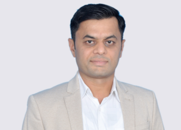
From day one to driving impact: Haresh on his early journey at AtkinsRéalis
Meet Haresh, driving direction, strengthening delivery, and building global alignment from the very start.
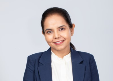
“Recognition, reflection, and responsibility”: Nidhie on leading UK infrastructure frameworks from India, mentoring with purpose, and what IWD really means
From Gurgaon to the UK, read how Nidhie drives complex infrastructure delivery with clarity, calm, and conviction.
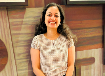
“I discovered a deep love for art”: Sangeeta on nuclear engineering, fusion technology, and finding creativity where you least expect it
Meet Sangeeta, an engineer who discovered a surprising love for art. Read how she blends creativity with her work on global projects.
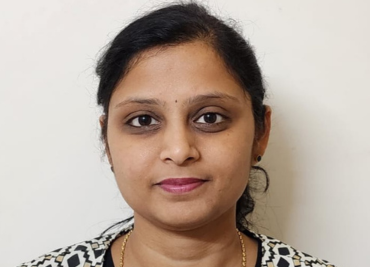
“A full pot never spills”: Akhilamba on Himalayan treks, a ‘before 50’ list, and 15 years growing from Junior Engineer to leading a team of 22
Meet Akhilamba, a leader whose journey is shaped by curiosity, grit, and a passion for pushing her own boundaries.
“Opportunities arrived without me having to ask”: Alankrita on teaching 700 students, mothering twin boys, and building a borderless journey from the classroom to global delivery
Meet Alankrita, a project manager who rebuilt her career across borders. Read how she turned teaching, leadership, and courage into a global journey.