Let’s find your next opportunity
AI Assistant: {{ chat.assistant.message }}
{{meta?.totalCount}}
results found
Sort By
{{ job.job_posting_title
}}
{{ job.job_posting_title }}
{{ job.is_cms_job ? (job.cities.split(';').length > 1 ? 'Various locations' : job.location_mappings[0]) : (job.location_mappings.length > 1 ? 'Various locations' : job.location_mappings[0]) }}
We are sorry there are no jobs that match your exact criteria. Try a new search term, or use the filters to continue browsing for available opportunities.
Suggested roles matches
{{ job.title }}
{{ job.title }}
{{ [job.cities[0], job.regions[0], job.countries[0]].join(', ') }}
Various locations
We are sorry there are no jobs that match your exact criteria. Try a new search term, or use the filters to continue browsing for available opportunities.
Let’s find your next opportunity
{{ job.job_posting_title
}}
{{ job.job_posting_title }}
{{ job.is_cms_job ? (job.cities.split(';').length > 1 ? 'Various locations' : job.location_mappings[0]) : (job.location_mappings.length > 1 ? 'Various locations' : job.location_mappings[0]) }}
On this page
Bangalore, Karnātaka, India
Overview
At Global Technology Center (GTC), Bengaluru, we are looking for motivated, experienced individuals who can be part of the GTC Geospatial team. The role – Geomatics Analyst-I is an exciting and rewarding opportunity for the right person to gain experience in Geospatial analysis and implementing Geospatial solutions across multiple disciplines and through all parts of a project's life cycle. Project managing candidate responsible for Geospatial analysis projects across engineering disciplines. Managing a large-scale data capture project or working on a High-Speed Rail / Network Rail / Highways or other Infrastructure projects.
The Geomatics Analyst will be responsible for processing, analyzing, and validating high-quality geospatial datasets derived from LiDAR, aerial imagery, and other remote sensing sources. The role requires hands-on experience with geospatial production workflows for North American and European projects, adherence to international accuracy standards, and the ability to work in a fast-paced production environment.
Your role
- Perform end-to-end LiDAR data processing, including classification, feature extraction, DEM/DSM generation, point cloud editing, and quality assurance.
- Execute photogrammetry workflows such as aerial triangulation, stereo compilation, ortho-rectification, orthomosaic generation, and 3D feature capture.
- Develop and maintain topographic, planimetric, and cadastral datasets for US/UK/Canada regions following Federal, State, or Local data standards.
- Conduct data QC/QA, ensuring accuracy, completeness, and compliance with client specifications (e.g., ASPRS, USGS LiDAR Base Specification, Ordnance Survey standards).
- Interpret and correct horizontal and vertical datums, coordinate systems, and projections commonly used in North America and Europe.
- Work with project leads to estimate effort, plan production schedules, and maintain documentation.
- Collaborate with cross-functional teams (GIS, CAD, Development, QA) to support end-to-end geospatial solutions.
- Prepare technical reports, metadata, and deliverables for client submission.
- Support automation enhancements through scripts/macros where applicable.
Location
Bangalore, Karnātaka, India
Job Type
Full time
Ref
R-148577
Salary range
-
About you
- Excellent communication skills in written and spoken English.
- Able to deal and motivate staff and earn loyalty and respect.
- Able to define and articulate ideas with clarity.
- French Language speaking will be an added advantage.
Education:
- Bachelor'S or Master's degree in Geomatics, Geoinformatics, Remote Sensing, GIS, Civil Engineering, Geography, or related fields.
Technical:
- 4–6 years of hands-on experience in LiDAR and Photogrammetry production environments.
Essential:
- Proficiency in tools such as:
- LiDAR: Terrasolid (TerraScan, TerraModeler), LAStools, Global Mapper, LP360
- Photogrammetry: Trimble Inpho, ERDAS IMAGINE Photogrammetry Suite, SOCET GXP, DAT/EM Summit Evolution
- GIS/CAD: ArcGIS Pro/Desktop, QGIS, AutoCAD, MicroStation
- Strong understanding of LiDAR classification schemas, noise filtering, surface modeling, breakline enforcement, and hydro-flattening.
- Experience handling stereo imagery, point clouds, and 3D mapping workflows.
- Knowledge of geodetic principles, coordinate systems, datums (NAD83, NAVD88, WGS84, OSGB36, CGVD), and transformation methods.
- Ability to interpret USGS, ASPRS, FEMA, NRCan, and Ordnance Survey data standards.
- Solid understanding of raster and vector data formats, accuracy assessments, and metadata creation.
- Excellent analytical, problem-solving, and communication skills.
- Knowledge of Python, FME, or automation scripts for geospatial workflows.
- Experience with UAS/drone data processing, Structure-from-Motion (SfM), and 3D reconstruction.
- Exposure to machine learning / AI-based feature extraction using LiDAR or imagery.
- Familiarity with cloud-based geospatial platforms (AWS, Azure, ArcGIS Online).
- Understanding of mapping standards like OS MasterMap, US Parcel datasets, and municipal utility mapping.
- Basic exposure to BIM/GIS integration or CAD-based design workflows.
- Experience in client communication or international project coordination.
- Strong attention to detail and commitment to data accuracy.
- Ability to work independently and in a team-oriented, multicultural environment.
- Adaptability, willingness to learn, and proactive problem-solving.
- Time management skills and ability to meet project deadlines.

Why choose AtkinsRéalis?
Wherever you are in your career – and whoever you are – AtkinsRéalis is for you. Here, support and collaboration are a vibrant part of a culture that lets you choose where – and how far – your career can go. Take on projects that push boundaries and drive sustainable impact, surrounded by colleagues who believe there's no limit to how brilliant you can be. It's time to join a like-minded team where you'll be rewarded, supported, and free to be your kind of brilliant.
Reward & benefits
Explore the rewards and benefits that help you thrive – at every stage of your life and your career.
Explore the rewards and benefits that help you thrive – at every stage of your life and your career. Enjoy competitive salaries, employee rewards and a brilliant range of benefits you can tailor to suit your own health, wellbeing, financial and lifestyle choices. Make the most of a myriad of opportunities for training and professional development to grow your skills and expertise. And combine our hybrid working culture and flexible holiday allowances to balance a great job and fulfilling personal life.
Seize every opportunity to sharpen your skills, expand your expertise, and be recognized for the impact you make.
Make it brilliant, a career with AtkinsRéalis
Our supportive, collaborative culture inspires us as a global community every day.
Watch this short film and imagine what you could achieve here, too.

About AtkinsRéalis
We're AtkinsRéalis, a world-class engineering services and nuclear organization. We connect people, data and technology to transform the world's'infrastructure and energy systems. Together, with our industry partners and clients, and our global team of consultants, designers, engineers and project managers, we can change the world. We're committed to leading our clients across our various end markets to engineer a better future for our planet and its people.
Related jobs
Related blogs
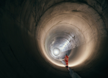
Thames Tideway Tunnel
Designing the western section of London’s 25km super sewer, AtkinsRéalis helped deliver one of the largest wastewater infrastructure upgrades in the city’s history, transforming how London protects the Thames for generations.

How AtkinsRéalis UK&I supports employee wellbeing?
A quick look towards a healthier, happier workplace. Find out how we help you to thrive.

“Recognition, reflection, and responsibility”: Nidhie on leading UK infrastructure frameworks from India, mentoring with purpose, and what IWD really means
From Gurgaon to the UK, read how Nidhie drives complex infrastructure delivery with clarity, calm, and conviction.

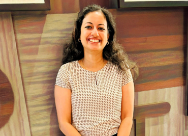
“Small improvements at design stage can make a big difference”: Pooja on water infrastructure, working across borders, and never giving up on yourself
From designing critical systems to strengthening global teamwork, read how Pooja creates meaningful impact behind the scenes.
“I discovered a deep love for art”: Sangeeta on nuclear engineering, fusion technology, and finding creativity where you least expect it
Meet Sangeeta, an engineer who discovered a surprising love for art. Read how she blends creativity with her work on global projects.
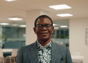
Mayowa: Aligning budget, planning, and strategy to deliver excellence
Meet Mayowa, Project Manager at AtkinsRéalis.

At the heart of environmental assessments: Nancy’s essential role
Meet Nancy, Senior Environmental Planner and Project Manager at AtkinsRéalis.

At the heart of nuclear safety: Yang’s civil engineering expertise
Discover Yang, a senior nuclear civil engineer at Candu Energy Inc., an AtkinsRéalis company.
Coralie, at the crossroads of strategic communication and the field
Meet Coralie, Senior Manager, Communications, Projects and Assets at AtkinsRéalis.
Souvik: A nuclear leader and mentor dedicated to shaping a sustainable energy future
Discover Souvik, Nuclear Director of Reactor Engineering within the Engineering Excellence division.
Claudia: building dams that power our communities
Discover Claudia, a structural engineer specializing in dams at AtkinsRéalis.
Amin: Shaping the future of infrastructure and water resources in Canada
Meet Amin, Team Lead for Municipal Infrastructure and Head of the Water Resources Group at AtkinsRéalis.